CAR_ME Carnia medioevale.
Research
CAR_ME Carnia medioevale.
Trasformazione del paesaggio umano dal IV al XIV secolo in area montana
Responsabile scientifico: Simonetta Minguzzi
Finanziamento:
Dipartimento di Eccellenza
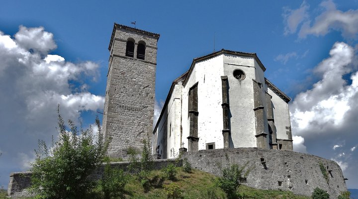
The project investigates the transformation of the human landscape between the 4th and 14th centuries in the Tolmezzo basin, a strategic area connecting the Friulian plain and Noricum. The initiative integrated historical, archaeological, and cadastral sources with field surveys and advanced technologies (LiDAR, drone photogrammetry, geophysical prospections), creating a GIS database for the management, analysis, and enhancement of the medieval mountain landscape.
The dissemination of results is planned through scientific workshops and future publications, once the historical analysis of the data collected in the field is completed.
Objectives
- Digitization and updating of historical and archaeological data concerning the settlement evolution of the Tolmezzo basin.
- Integrated analysis of written, cartographic, toponymic, archaeological, and cadastral sources.
- Identification and surveying of significant archaeological sites (e.g., Pieve S. Floriano di Illegio, Pieve Arcidiaconale di Santa Maria oltre But, Castello di Cort del Salvan) using LiDAR, UAV photogrammetry, and geophysical prospections.
- Creation of a queryable GIS database with detailed records for each site, including location, context, chronology, description, sources, and iconographic documentation.
- Production of thematic maps and analytical tools for historical research, heritage protection, and territorial planning.
Results in the field of DH
- Collection and systematization of historical and archaeological data on 37 sites, including both known and newly identified locations.
- Implementation of LiDAR and drone photogrammetric surveys, producing DSM, DTM, and color orthophotos, integrated with geophysical anomalies potentially related to archaeological features.
- Creation of detailed GIS records with contextual information, iconographic documentation, and historical and archival references, enabling queries and thematic visualizations of the territory.
- Development of digital tools supporting spatio-temporal analyses of medieval settlements, useful for reconstructions and comparative studies.
Image: Rollroboter – CC BY-SA 4.0